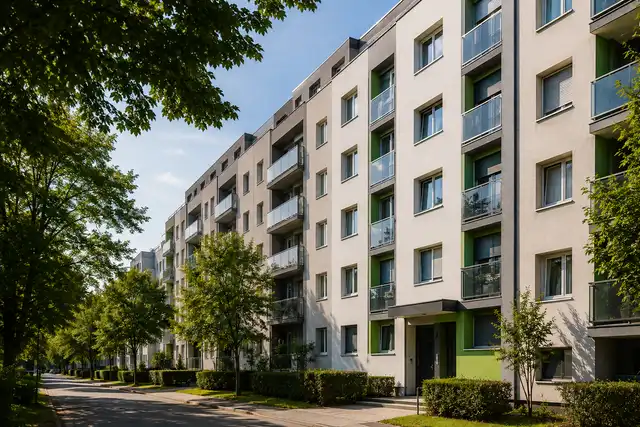
Imagine this scenario: you've found the perfect house, agreed on the price, hired a notary – and then it turns out that what's written in the cadastre doesn't match what's in the land registry. The deal falls through, and you're left without the property and with a legal headache that can last for years.
Such situations are not an exception in practice – they are surprisingly common on the Croatian real estate market.
The difference between the cadastre and the land registry is a fundamental problem that troubles buyers, sellers, and heirs. These are two separate systems that theoretically should describe the same reality, but often describe completely different things.
In short: the cadastre describes the physical reality of a parcel – its shape, area, and purpose. The land registry, on the other hand, states who the legal owner is and whether there are any encumbrances or mortgages. Only a property registered in the land registry has full legal protection – the cadastre itself does not grant ownership.
The goal of an "arranged land" (uređena zemlja) as a concept is precisely to bridge this gap. A modern solution has proven to be the Joint Information System (ZIS), which aims to merge both registers into a single entity.
However, to understand why discrepancies arise, we must first clearly distinguish what each of these systems actually measures – and who manages them.
Cadastre vs. Land Registry: Key Differences You Must Understand
Most real estate buyers have heard of both terms, but rarely does anyone truly understand why they are two separate systems – and why this distinction can be crucial for your legal security.
Cadastre: The Body That Measures, Not Proves Ownership
The cadastre is a record managed by the State Geodetic Administration (DGU). Its primary purpose is to record the physical characteristics of land – shape, size, use, and location. When your name appears in the cadastre, it's accompanied by a special term: "posjednik" (possessor). This means you are the person who uses the property or has registered it for tax purposes – but it absolutely does not mean you are the legal owner.
Land Registry: The Only Record That Guarantees Ownership
The land registry (zemljišna knjiga) is under the jurisdiction of municipal courts and is the only legal source that defines who owns a property. All real rights are also recorded here – mortgages, easements, usufructs, and other encumbrances. Without registration in the land registry, legally speaking, you are not the owner, regardless of whether you have paid the purchase price.
Being registered in the cadastre does not make you the owner – it's just a record of who actually uses the property, not who legally belongs to it.
Why Does This Difference Create Problems?
This is precisely where the core of the issue lies as to why cadastre and land registry data do not match. Both systems were created independently of each other and were not synchronized for a long time. Only with the introduction of systems like the Joint Information System (ZIS) is an attempt being made to bridge this gap – but as we will see, the reasons for discrepancies go much deeper into history and practice.
Why Doesn't the Data Match? Three Main Causes of Chaos
When it is discovered that the cadastre and land registry show different data, the owner's first reaction is usually confusion – and then panic. However, this situation is not a random system error. Behind the discrepancies are concrete, deeply rooted reasons that are important to understand before you even start thinking about how to harmonize the cadastre and the land registry.
1. Historical Legacy: Austro-Hungarian Surveys Meet Modern Geodesy
The foundations of today's cadastral system in Croatia were laid in the 19th century, during the Austro-Hungarian Monarchy. The land surveys of that time were conducted with the equipment and methodology available then – meaning that parcel areas, boundaries, and shapes often deviated significantly from the actual state. Modern geodetic measurements, using satellite technology and digital tools, regularly reveal these differences. The result? A parcel that was recorded as 800 square meters in old books may measure 720 – or 860 today.
2. Generational Neglect: Inherited Properties "By Word of Mouth"
Inheritance without probate proceedings is one of the most common pitfalls in Croatian practice. For decades, families have transferred land and houses among themselves – through sale, gift, or simply by moving – without anyone initiating court registration proceedings. The cadastre might have been updated for tax obligations, but the land registry would remain frozen in the past, still registered to a long-deceased ancestor.
An unregistered property legally exists only for the tax administration – for everyone else, the owner on paper is someone who is no longer alive.
3. Systemic Lag: Taxes Today, Registration Perhaps Never
There is a time lag between updating the cadastre and updating the land registers that can last for years. Changes in the cadastre are often carried out quickly because they are tied to tax obligations, while registration in the land registry requires court proceedings, documents, and active involvement of the owner. Without this step, the two registers continue to live parallel lives – and each tells a different story about the same property.
Understanding these causes is only the first step. The real question is: what are the concrete consequences of these discrepancies – and how much can they cost you?
Dangers of Discrepancies: What You Risk with 'Unsorted' Papers
Understanding why there are discrepancies between records is useful in itself – but the real motivation for solving the problem lies in the concrete risks that an unsorted cadastre and land registry pose to the everyday owner. And these risks are not minor.
The Bank Will Say "No"
Financial institutions check land registry extracts with extreme care when approving mortgage loans. If the ownership list shows unclear ownership, encumbrances, or discrepancies with cadastral data, the loan application will be rejected – without exception. In practice, this means that a sale can fall apart at the last minute, and the seller is left with a property that is difficult to sell.
The Principle of Public Trust: A Hidden Threat
This may be the most difficult to understand, but also the most dangerous risk. The principle of public trust, guaranteed by the Land Registry Act, means that a third party who relies on the state of the land registry and buys a property in good faith can acquire legally valid ownership – even if you are the actual possessor. As tportal.hr reports, the difference between the cadastre and the land registry is not just administrative – it can have serious legal consequences.
Building Permit and Market Value
Without harmonized data, there is no building permit. The competent authority simply cannot confirm that you are building on a plot that legally belongs to you. In addition, experienced buyers and their lawyers immediately recognize unsorted documentation – and ask for a discount that can be up to 15-20% of the market value.
Unsorted papers are not just an administrative nuisance – they are a financial and legal bomb with a delayed fuse.
Fortunately, you can check the status of your properties quickly and for free today through digital tools – which the next section discusses.
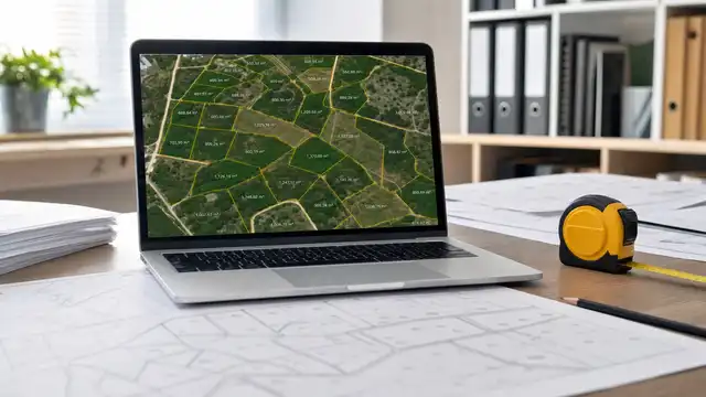
How to Check the Status Online: A Guide to the 'Uređena Zemlja' Portal
Before you start any harmonization process, it's worth taking one simple step – check the current status from the comfort of your own home. The 'Uređena Zemlja' portal (available at oss.uredjenazemlja.hr) allows all citizens quick access to cadastre and land registry data through a unified interface, known as OSS (One Stop Shop).
How to Search for Data?
The search is intuitive. You can search by:
Parcel number – enter the cadastral municipality and parcel number
Possession list – useful if you already have a document from the cadastre
The system then displays data from the Joint Information System (ZIS) – an integrated database that combines data from the State Geodetic Administration and land registry courts. It is precisely here that the cadastre vs. land registry differences become visible: if the data is not harmonized, ZIS will show discrepancies in the area, shape of the parcel, or the registered owner.
Informational View vs. Legally Valid Extract
Many overlook this distinction, and it is of key importance. The informational copy available online is free and useful for your own verification, but it has no legal force in proceedings before a court or a notary. For sales, mortgages, or inheritance, a certified land registry extract issued officially is always required.
An informational view reveals the problem, but does not solve it – for legal certainty of the property, certified documents and a formal procedure are required.
Once you determine that there are discrepancies, the natural question arises: what next? The answer lies in the concrete steps of harmonization.
Steps for Harmonization: How to Get 'Clean Papers'
After you have determined a discrepancy between cadastral and land registry data, the logical question is: how to resolve it? The harmonization procedure has clear steps, but requires patience and coordination with several institutions.
1. Engaging an Authorized Geodesist
The first and most important step is to engage an authorized geodesist who prepares a geodetic report – an official document that precisely describes the actual situation on the ground. The geodesist measures the parcel, determines the boundaries, and documents all relevant data. Without this report, no further procedure is possible. The costs of preparation typically range between 300 and 800 euros, depending on the complexity of the case and the size of the property.
2. Individual Correction Procedure
When the difference between the records is not the result of an error, but of an inherited situation, the Individual Correction Procedure (PIP) is applied. This administrative mechanism allows for the harmonization of data between the cadastre and the land registry without a lengthy court process. In practice, this procedure resolves most cases where the possession list vs. ownership list show discrepancies in the area or shape of the parcel.
3. Submission to the Land Registry Court
The geodetic report, along with supporting documentation, is submitted to the land registry court. The court verifies the validity of the request and, if everything is in order, issues a decision on harmonization. The process can take from a few weeks to several months, depending on the court's workload and the complexity of the case.
Key Takeaways
Harmonizing the cadastre and land registry is not a one-time expense – it is a long-term investment in the legal security of your property.
Engage a geodesist as soon as possible
Check the status via the Uređena Zemlja portal before initiating proceedings
Count on total costs of 500 to 1,500 euros
Sorted papers mean fewer obstacles when selling, inheriting, or obtaining mortgage financing – it's worth taking the first steps today.

Currently popular
Guides / 29-06-2026
Building and Apartment Energy Renovation: Steps, Benefits, and Cost-Effectiveness
TL;DR: Energy renovation of multi-apartment buildings in Croatia in 2026 means a set of technical and organizational measures that reduce energy consumption for heating and cooling, improve living comfort, and increase the market value of the property. The process relies on the new Law on Energy Efficiency in Buildings (NN 155/25), energy audits, design, ...
Guides / 25-06-2026
Land parcelization in Croatia: what it is, when it is needed, and how it is carried out?
Land partitioning in Croatia is a geodetic-legal procedure by which one cadastral parcel is divided into several new ones, or multiple parcels are merged into one, with changes implemented in the cadastre and land registry. In practice, it is most often important when you want to sell a part of the land, form a building plot, resolve co-ownership ...

Guides / 24-06-2026
Location permit, building permit, and location information: what is the difference and what you need to know
Location permit and building permit in Croatia are not the same, although they are often confused in practice. A location permit determines whether a specific intervention in space is in accordance with the spatial plan and special regulations, while a building permit approves the construction itself based on the main project. Location information is a ...

Architecture & Design / 23-06-2026
Virtual tours and 3D tours: how to view a property without leaving home
Virtual tours and 3D walkthroughs are defined as interactive digital representations of spaces that allow customers to independently view properties via a browser, without physical presence. Unlike static photographs, this technology provides complete freedom of movement through the space, insight into real dimensions and room layout, and a sense of ...